


Mumbai Grasped by Earliest Monsoon Onset, Red Alert Declared
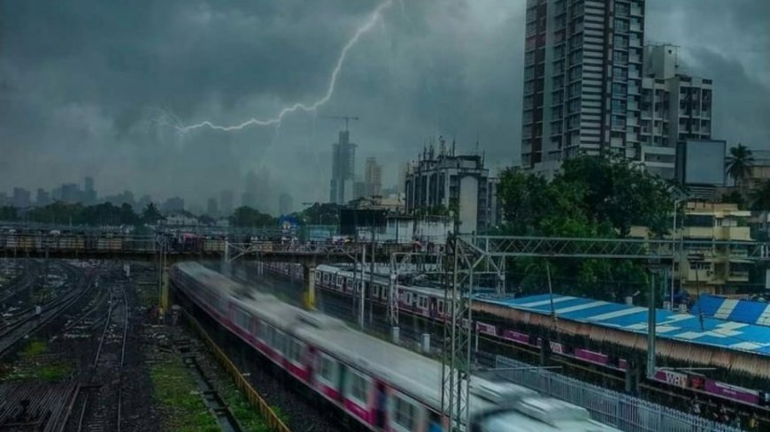
The southwest monsoon has made a record early entry into Mumbai today, May 26, 2025, registering the city's earliest onset on record and shattering a 107-year May rainfall record. A red alert was issued for Mumbai, Thane, and Raigad by the India Meteorological Department (IMD) due to extremely heavy rain at isolated locations.
The pre-monsoon rains
A major 16 days ahead of its usual June 11 arrival in Mumbai, has been relentless since early morning, causing extensive waterlogging, traffic congestion, and significant disruption to suburban train operations in the city.
Measurement of rainfall
The Colaba observatory clocked an incredible 135.4 mm of rain in the 24 hours until 8:30 am on Monday, classifying it as "very heavy rain." This colossal rain fall also witnessed Colaba shattering its all-time May rain fall record, recording 295 mm so far this month, beating the old May 1918 record of 279.4 mm. Meanwhile, the Santacruz observatory in the suburbs measured 33.5 mm.
Condition of other places of Mumbai
Low-lying regions like Breach Candy, Kemps Corner, Sion Circle, Dadar TT, Hindmata, and JJ Marg Post Office are witnessing heavy waterlogging. Nariman Point accounted for a whopping 104mm of rainfall from 9 am to 10 am alone, one of the season's highest hourly readings.
Effect of this heavy rainfall
Commuters are greatly affected, with local train runs on the Central Railway and Harbour Line being delayed due to water-logged tracks. While Western Railway operations have more or less been normal, road traffic has greatly suffered, resulting in diversion of buses, bottlenecks on major arterial roads, and partial closures. Mumbai Metro line 3 between Acharya Atre Chowk and Worli too had its operations suspended due to flooding.
IMD Alert
The IMD had first warned of a yellow alert for Mumbai, which was later changed to an orange alert and finally to a red alert as the rainfall intensity increased. The weather department predicts sustained light to moderate rain with thunder and gusty winds over the next 24 hours. An expected high tide of 4.75 meters at 11:24 am today adds to concerns regarding possible waterlogging.